-
Old World Auctions (Nov 12):
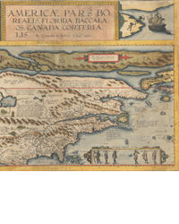
Lot 75. The Second Printed Map of the North American Continent - Full Contemporary Color (1593) Est. $35,000 - $40,000Old World Auctions (Nov 12):
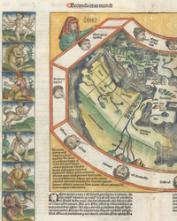
Lot 37. Schedel's Ancient World Map with Fantastic Humanoid Creatures (1493) Est. $16,000 - $18,000Old World Auctions (Nov 12):
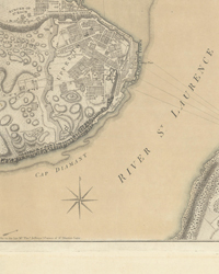
Lot 104. Important Revolutionary War Plan of Battle of Quebec in Contemporary Color (1776) Est. $4,000 - $4,750Old World Auctions (Nov 12):
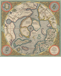
Lot 43. Mercator's Map of the North Pole - the First Printed Map Devoted to the Arctic (1606) Est. $2,750 - $3,500Old World Auctions (Nov 12):
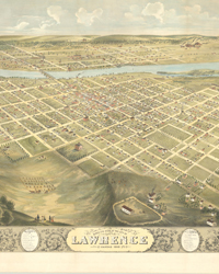
Lot 237. Rare and Striking Bird's-Eye View of Lawrence, Kansas (1880) Est. $2,000 - $2,500Old World Auctions (Nov 12):
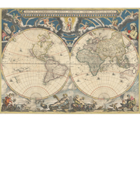
Lot 10. Rare Map from Atlas Maior with Representations of the Seasons in Contemporary Color (1662) Est. $14,000 - $17,000Old World Auctions (Nov 12):
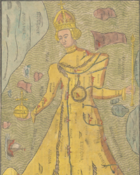
Lot 374. Bunting's Map of Europe Depicted as the Queen of the World (1589) Est. $2,000 - $2,400Old World Auctions (Nov 12):
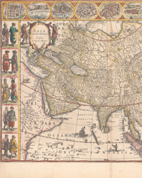
Lot 590. Willem Blaeu's Magnificent Carte-a-Figures Map of Asia (1634) Est. $2,750 - $3,500Old World Auctions (Nov 12):
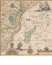
Lot 647. The Earliest and Most Decorative Map of the East Coast of Africa (1596) Est. $3,000 - $3,750Old World Auctions (Nov 12):
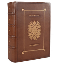
Lot 710. Ruscelli's Complete, Third Edition Atlas with 65 Maps (1574) Est. $9,500 - $11,000Old World Auctions (Nov 12):
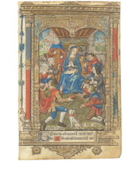
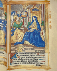
Lot 696. Superb Hand-Colored Image of the Adoration of the Shepherds (1502) Est. $800 - $950 -
University Archives
Rare Autographs, Manuscripts & Books
Now through Nov. 19University Archives, Nov. 19:
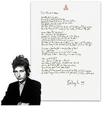
Lot 308 - Bob Dylan Handwritten & Signed Lyrics to "Just Like a Woman" With Jeff Rosen & JSA AuthenticationUniversity Archives, Nov. 19:
Lot 455 - Isaac Newton Admiration For Judaism & Moral Continuity With Christianity! 350+ Words in his Hand - Extraordinary Content!University Archives, Nov. 19:
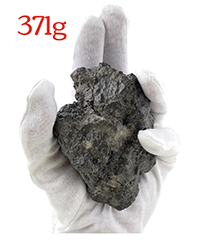
Lot 219 - 371g Moon Meteorite, Incredible Find - Laâyoune 002University Archives
Rare Autographs, Manuscripts & Books
Now through Nov. 19University Archives, Nov. 19:
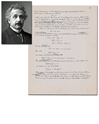
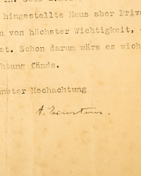
Lot 448 - Scarce Einstein AM on Unified Field Theory, 180+ Words & 11 Equations in His Hand! From His Published Article, "A Generalization of the Relativistic Theory of Gravitation"University Archives, Nov. 19:
Lot 159 - Woodrow Wilson Baseball Signed for WWI Red Cross Fundraiser, Ex. Forbes & PSA Authentic - Finest Known!University Archives, Nov. 19:
Lot 84 - Lee Harvey Oswald ALS to Brother, Trying Desperately to Get out of Russia! Highly ImportantUniversity Archives
Rare Autographs, Manuscripts & Books
Now through Nov. 19University Archives, Nov. 19:
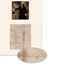
Lot 152 - George Washington Signed Discharge for MA Solider Whose Regiment Was at Bunker Hill!University Archives, Nov. 19:
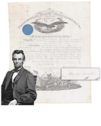
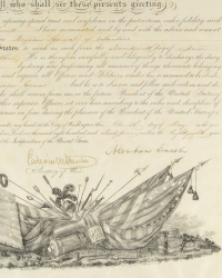
Lot 88 - Abraham Lincoln Fully Signed Military Appointment for Mexican War Vet & Respected CavalrymanUniversity Archives, Nov. 19:
Lot 188 - Apollo XI Astronauts & Their Wives Signed Photo, Plus Crew Signed Cover, From Apollo XI Presidential Goodwill Tour Era, Pre-Cert ZarelliUniversity Archives
Rare Autographs, Manuscripts & Books
Now through Nov. 19University Archives, Nov. 19:
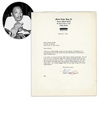
Lot 265 - Martin Luther King, Jr. TLS Re: "Stride Toward Freedom" Film Rights To Literary Agent Marie RodellUniversity Archives, Nov. 19:
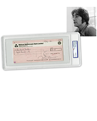
Lot 324 - John Lennon Signed Apple Records Check, PSA GEM MT 10! Possibly Finest KnownUniversity Archives, Nov. 19:
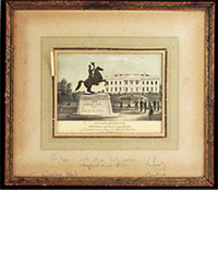
Lot 79 - John & Jacqueline Kennedy Signed WH 1963 Christmas Gift Inscribed to Close Friend Joan Braden, PSA Authentic -
Rare Book Hub is now mobile-friendly! -
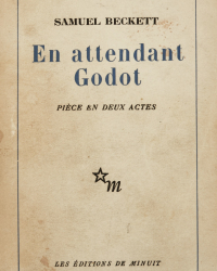
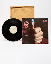
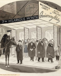
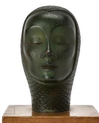
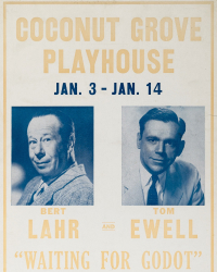
Doyle, Nov. 5: The Director's copy of the first edition of Samuel Beckett's Waiting for Godot, inscribed by Beckett. $7,000 to $10,000.Doyle, Nov. 5: Don McLean's personal test pressing of American Pie before mass production, gifted in 1971. $8,000 to $12,000.Doyle, Nov. 5: The important and extensive archive of original fashion photographs of model Dorothy Rice, 1945-58. $20,000 to $30,000.Doyle, Nov. 5: A Charles Adams theater advertisement. $8,000 to $12,000.Doyle, Nov. 5: A Small Patinated Bronze Bust of Marlene Dietrich. $800 to $1,200.Doyle, Nov. 5: Marlene Dietrich Studio Photograph. $100 to $200.Doyle, Nov. 5: The very large and uncommon British Quad for Hitchcock's The Birds. $500 to $800.Doyle, Nov. 5: An Original Crystal "Sputnik" from the 1966 Met Opera Chandelier. $3,000 to $5,000.Doyle, Nov. 5: The rare poster from the first American performances of Endgame, 1958. $1,000 to $1,500.Doyle, Nov. 5: The original Coconut Grove Playhouse poster for Waiting for Godot, possibly unique. $3,000 to $5,000.
Arader Galleries: Arader Auction , 91325, New York City
Auction Details
- Auction Date
- September 13, 2025 - September 13, 2025
| Lot Number | Author Name | Book Title | Place Printed | Year Published | Estimate | Actual Price |
|---|---|---|---|---|---|---|
| 101 | DE HOOGHE, Romeyn (1645-1708). | [South English Coast, River Thames] Carte Nouvelle des Costes d'Angleterre depuis la Riviere de la Tamise jusques a Portland, & des Isles Voisines. |
Amsterdam | 1693 | USD 2,000.00 - 4,000.00 | Not Sold |
| 102 | MERRIOTT, Jack (British, 1901-1968). | Northumberland Coast, Bamburgh and the Farne Islands, [British Railways]. |
Published by the Railway Executive | USD 2,000.00 - 3,000.00 | USD 1,320.00 | |
| 103 | RICHMOND, Leonard (British, 1889-1965). | Hastings and St. Leonard [British Railways]. |
Printed by Haycock Photochrom. | ca. 1927. | USD 1,200.00 - 1,800.00 | USD 840.00 |
| 104 | SPEED, John (1552-1629). | The Countie of Leinster with Citie Dublin Described. |
London | 1610 | USD 1,000.00 - 1,500.00 | USD 720.00 |
| 105 | TAVERNIER, Melchior (1564-1641). | Carte G?ographique des Postes qui trauersent la France. |
Paris | c. 1632. | USD 1,000.00 - 1,500.00 | Not Sold |
| 106 | SANSON, Guillaume (1633-1703). | Le Royaume de France divise en toutes ses provinces... |
Amsterdam | circa 1721 or later. | USD 5,000.00 - 10,000.00 | Not Sold |
| 107 | [Original Watercolor, Normandy, France]. | Veiie du chasteau de Lo?ye en Normandie a siz lienes d'Evreux et ? d'Anet et de Dreux, 1702. |
ca. 1702. | USD 1,500.00 - 2,500.00 | Not Sold | |
| 108 | HOMANN, Johann Baptist (1664-1724). | Prospect und Grundriss der Weltberuhmten Konigliche Haubt Stadt Paris... |
Nuremberg | c. 1730. | USD 1,000.00 - 1,500.00 | USD 600.00 |
| 109 | VENUTI, Ridolfino (1705-1763). | [Map of Ancient Rome] Carta Topografica delle Antichita Di Roma... |
Rome | 1763 | USD 500.00 - 700.00 | USD 360.00 |
| 110 | PROBST, George Balthasar (1732-1801). | Loretto. |
Augsburg | c 1760. | USD 1,800.00 - 2,800.00 | Not Sold |
| 111 | HOMANN, Johann Baptist (1664-1724). | Novissima & Exactissima Totius Regni Neapolis... |
Nuremberg | c. 1720. | USD 600.00 - 800.00 | Not Sold |
| 112 | HOMANN Heirs (18th Century). | Insulae Corsicae... |
Nuremberg | c. 1735. | USD 600.00 - 800.00 | Not Sold |
| 113 | SANQUIRICO, Alessandro (1777-1849). | Carcere nel castello. |
Milan | ca 1827. | USD 2,000.00 - 4,000.00 | Not Sold |
| 114 | SANQUIRICO, Alessandro (1777-1849). | Sotterraneo. |
Milan | ca 1827. | USD 2,000.00 - 4,000.00 | Not Sold |
| 115 | KAHLER, F. W. (19th century). | Buenos-Ayres [Argentina] / A Vista De Pajaro. |
Hamburg | 1898 | USD 1,500.00 - 3,000.00 | Not Sold |
| 116 | MORDEN, Robert (1669 - 1703); BERRY, WIlliam (1639 - 1718). Engraved by HOLLER, Wenceslaus. | A New Map of the English Plantations in America both Continent and Ilands, Shewing their True Situation and Distance from England or One with Another... |
London | 1673 (1677) | USD 18,000.00 - 25,000.00 | Not Sold |
| 117 | HOMANN, Johann Baptist (1664-1724). | Totius Americae Septentrionalis et Meridionalis Novissima Repraesentatio... |
Nuremberg | c. 1742. | USD 1,800.00 - 2,800.00 | USD 1,200.00 |
| 118 | HOMANN, Johann Baptist (1664-1724). | Regni Mexicani sue Novae Hispaniae... |
Nuremberg | c 1730. | USD 1,000.00 - 1,500.00 | USD 660.00 |
| 119 | DES BARRES, Joseph Frederick Wallet (1722-1824). | A Chart of Port Royal and Kingston Harbours, in the Island of Jamaica. |
London | c. 1781. | USD 4,000.00 - 8,000.00 | Not Sold |
| 120 | DE L'ISLE, Guillaume (1675-1726). | Carte du Mexique et da la Floride... |
Paris | 1745 | USD 1,200.00 - 2,200.00 | USD 1,200.00 |
| 121 | POPPLE, Henry (d.1743). | Carte Particullere De L'Amerique Septentrionale / A Map of the British Empire in America with the French, Spanish and the Dutch settlements... |
Amsterdam | [c. 1740]. | USD 1,800.00 - 2,800.00 | USD 1,920.00 |
| 122 | DELAMARCHE, Charles Francois (1740-1817). | Etats-Unis De L'Amerique Septentrionale... |
Paris | c. 1785. | USD 2,500.00 - 4,500.00 | Not Sold |
| 123 | REID, John (fl. c. 1775 - c. 1800). | An Accurate Map of the United States of America according to the Treaty of Paris of 1783. |
New York | 1796 | USD 600.00 - 800.00 | USD 480.00 |
| 124 | ARNOLD, E.G. (19th Century). | Topographical map of the original District of Columbia and environs: Showing the Fortifcations around the City of Washington. |
New York | 1862 | USD 4,000.00 - 8,000.00 | USD 12,000.00 |
| 125 | Ensign, Thayer [&Co.] (19th Century). | Ornamental Map of the United States & Mexico / Map of the United States and Mexico Including Oregon, Texas and the Californias. |
New York | 1848 | USD 2,000.00 - 4,000.00 | USD 1,440.00 |



















![<b>Dominic Winter, Nov. 5:</b> Aquinas (Thomas). <i>[Summa Theologica], Secunda Parte,</i> Venice, 1496. £700 to £1,000. <b>Dominic Winter, Nov. 5:</b> Aquinas (Thomas). <i>[Summa Theologica], Secunda Parte,</i> Venice, 1496. £700 to £1,000.](https://ae-files.s3.amazonaws.com/AdvertisementPhotos/b69c37e7-f18c-4417-b08b-f00e9b97a413.jpg)
















![<b>Sotheby’s:</b> Lewis Carroll [Charles Lutwidge Dodgson], John Tenniel. <i>Alice's Adventures in Wonderland</i> First Edition. Macmillan & Co., 1866. $15,000. <b>Sotheby’s:</b> Lewis Carroll [Charles Lutwidge Dodgson], John Tenniel. <i>Alice's Adventures in Wonderland</i> First Edition. Macmillan & Co., 1866. $15,000.](https://ae-files.s3.amazonaws.com/AdvertisementPhotos/cc3f4f98-f195-4049-aca6-329c27fdd27c.png)